Showing posts with label hike. Show all posts

Tuesday, April 23, 2013

Hike: Lynn Peak

A few weeks ago, R and I did the Lynn Peak hike. We'd seen signs for it last summer while hiking the Lynn Headwaters, but it seemed a bit off the beaten track. I was talking to a coworker about hikes in that area in early April and took another look at Lynn Peak. I saw a recent comment on one of the hiking sites that said that it was good to hike now. We packed our gear (including R's new backpacking pack!) and headed out. We started hiking shortly before noon, I believe.

The top was a bit of a slog - it was covered in snow and fairly slippery. The view at the top was pretty worth it though!

Yes. That is Vancouver..

Burnaby & Vancouver

panorama of it.. Burnaby - Vancouver
 Stats:
Length: 3 hours, 45 minutes (from sign at trailhead)
Distance: 8.5km
Elevation gain: 720 m (according to this)

I'm not sure I'd do this hike again - the view was nice, but it wasn't an overly exciting trail. It was good as a starter for the year though.

Sunday, November 4, 2012

Hike: Seymour Canyon

Last weekend we tried to do the Two Canyon Loop through Seymour/Lynn Valleys, but there was a sign and trail name for everything but this one. I hadn't written it down beforehand so we just walked..

Gorgeous trees!


 R overlooking Seymour river with his fancy new backpack

 Gorgeous alders!
 
 And more..
 And one 'glowing' yellow tree, among the conifers

And a deer.

I think we ended up starting on the Homesteader's Trail, walking up the Fisherman's trail and then down the paved road.. for no reason other than we couldn't find the trail again... I'm not sure how!

It was really nice to be out hiking even in late October. I'm looking forward to doing some of the easier/lower elevation hikes this winter.

Sunday, September 16, 2012

Hike: Joffre Lakes

Today we finished out first overnight backpacking trip. We headed to Joffre Lakes, three alpine lakes which are quite accesible (11km RETURN!) from the highway just outside of Pemberton.

We left yesterday morning around 9:20am, and headed north. The drive was pretty, quiet and felt shorter than three hours. After a quick stop in Squamish for some last-minute groceries, we got to the (busy, full, crazy) trailhead around 12:20pm.

The first lake was visible within about 5 minutes, and the colour was incredible. It was pretty exciting to see the colour of the lake already, with the glacier in the background.


The next part was nice with some uphill parts. There was a good chunk of boulders to hike over, which would have been slightly more fun without my camera and giant bag, but.. that's life, right?

The second lake got me even more excited - we could get close to it and see it more than the first. Unfortunately there were still tons of people there..

 So beautiful! The colour is incredible.

Yay!!! :)

So. Then we started on the switch-back section. Not quite that lovely, but still nice. From this point it was only 1.5km to the third lake, our final destination (for the night).

 First glimpses..

 Can not get over the colour of these lakes.

 View from our campsite.

After we set up camp, we hiked (walked?) towards a rock bluff and some waterfalls.
 Impossible to get the colour from up there, but.. what a picturesque place!


Lovely!!

After that, we made dinner, played some cards in our tent (yep, 5 people sitting in a 2 person tent!) and went to bed. The downside of the gorgeous place is that the valley is quite narrow, and the sunset quite fast.

This morning we got up slowly (it took about 2 hours for all 5 of us to get up and out), had a leisurely breakfast (with chocolate cheesecake. Yeah.) and got a bit packed up. Then we headed for a hike towards the Tszil Glacier. We didn't really know how far it went, so we just headed up.

 The view before the sun came out this morning.

 And the view with the sun.

 That's the third lake down there.

This glacier looks much nicer in this photo than it did in person, but.. still awesome.

So.
Total length: 11km (plus glacier hike, ~5 km)
Time needed: 5 to third lake, 3 to glacier from third lake.
Difficulty: Not too bad. After the Hanes Valley hike, nothing is hard ;)

I think that's all. I'm excited to do more backpacking trips, now that I have a water filter, awesome stove, good friends, etc.

Thursday, August 23, 2012

Hike: Hanes Valley

After we got up to Norvan Falls almost two weeks ago, we saw a sign that said "Grouse, 9km." We instantly decided that we should hike it the next weekend, and so we did.

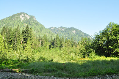
The first 10k was gorgeous - nice forests, a little hilly but not too bad, lots of creek crossings.. 


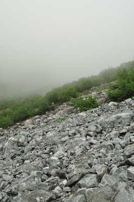
 I bet that this would be a stunning view on a sunny day..

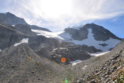
 Then we started to climb up stuff like this, with the rocks getting smaller and smaller, and the hill steeper and steeper..


I stopped taking photos after this point because it wasn't fun anymore. And stopping meant losing some momentum, which took forever to build.

We got to a 'false top' and then celebrated.. and then realized that we still had to go up. Not very fun! Eventually we made it down to Grouse and celebrated with beavertails devoured in about 2 seconds flat.

Location: Lynn Valley to Grouse.
Length: 15 km
Elevation: ~1000m gain
Time: Approximately 8ish hours.
Notes: Need two cars, or to take a bus to get to and from the trailhead/ends.

I don't think I'd ever do the full hike again, but the first ~10km to the boulder field (which I don't have photos of!) was really fun and beautiful. 

Sunday, August 12, 2012

Hike: Norvan Falls

Today we headed to Norvan Falls, in Lynn Valley.

R and I are planning an overnight hike in mid-September, and in order to prepare for that we decided to pack our big backpacks with our sleeping bags, tent, stove and some other stuff.

 The view at the "Third Debris Chute." Gorgeous day!!

 The bottom of the falls, where M went swimming.

 The falls.


Lunch - Hawaiian chicken with rice. Pretty good, actually. It did take quite a while to cook though (says 13 minutes, I'm not sure how long we left it) and they are pricey. We're going to work on making our own for upcoming trip.s

Lunch!


 Random suspension bridge. I believe this was a rebuild of a small wooden bridge. I guess it's a busy enough trail that they need it.. but it seemed a bit overkill to me. The other three really enjoyed bouncing on it though :)


Length: 13.5 km
Time: 5 hours (including ~1 hr lunch and meandering on the way down)
Difficulty: Easy

Tuesday, August 7, 2012

Hike: Ripple Rock

This past weekend R and I headed to Campbell River on Vancouver Island for a weekend of camping with my family.

On Saturday, we headed to north to hike to a viewpoint of Ripple Rock. The history of this place is pretty cool -- a huge explosion to destroy two rocks? Cool in my books! The straight where the rocks were is VERY narrow, even now, without the rocks. The tide was insanely fast too, which looked like fun for the boats playing in the narrows.

 Suspension bridge that R LOVED because he could bounce everyone on it.. my sister, not so much love.

 View of one of the beaches. Such a clear, hot hot hot day.

 Another 'viewpoint.'

 And another. Gorgeous.

 Somewhere near where the whirlpools are is where Ripple Rock was.

More whirlpools. So pretty!

Location: 19km north of Campbell River on highway 19A.
Time: 2.5ish hours, not walking super fast.
Total length: 8 km, although it felt a bit longer.


Wednesday, July 25, 2012

Hike: Minnekhada Regional Park

We were furniture shopping not too long ago out in Poco and we decided that we should go for a walk. D was dog-sitting a few dogs that weekend, so we decided to find a hike that he could bring them on. M ended up joining us as well and we headed out to Minnekhada Regional Park.

 The boys, and two VERY enthusiastic dogs.

 Some seriously giant trees.

 So green and pretty.. :)

 Moss. Love.
 Gorgeous wetland.


 R and one tired puppy.

Tired puppy number 2..

I think we 'hiked' for about 2 hours, but we probably could have done it in less. The walk itself was fairly easy, with little elevation gain. Trying to get the dogs to walk like normal dogs was almost impossible, and I think that was the reason that we were all kind of tired at the end.